Ancient History etiketine sahip kayıtlar gösteriliyor. Tüm kayıtları göster

14 Temmuz 2012 Cumartesi

World's Oldest Natural Pearl found in Arabia

World's Oldest Natural Pearl found in Arabia

French researchers have unearthed the oldest natural pearl ever found at a Neolithic site in Arabia, suggesting that pearl oyster fishing first occurred in this region of the world.

The oldest pearl in the world. (Credit: Ken Walton/CNRS.)
Discovered in the Emirate of Umm al Quwain, in the United Arab Emirates (UAE), the pearl was believed to have originated between 5547 and 5235 BC.
"Gemmologists and jewellers have popularised the idea that the oldest pearl in the world is the 5000-year-old Jomon pearl from Japan. Discoveries made on the shores of south-eastern Arabia show this to be untrue," Vincent Charpentier, Sophie Méry and colleagues at the French Foreign Ministry's archeological mission in the UAE, wrote in the journal Arabian Archaeology and Epigraphy.

Some 7,500 years old and 0.07 inches in diameter, the newly discovered pearl  is just the last of a series of findings at archeological sites in the Arabian Peninsula.

Over the years, researchers unearthed a total of 101 Neolithic pearls, coming from the large pearl oyster Pinctada margaritifera and from Pinctada radiata, a much smaller, easier to collect species, which provides higher quality pearls.
"The discovery of archaeological pearls demonstrates an ancient fishing tradition that no longer exists today," wrote the researchers.
Although diving for pearls was difficult and dangerous, mother-of-pearl was an important resource in the economy of local Neolithic societies, said the researchers. The large valves of P. margaritifera's were used to make fish hooks for the capture of fish as large as tuna and sharks, while spherically shaped pearls were collected for their esthetic value and for funeral rites.

Indeed, the Umm al Quwain pearl, which was not drilled, had been recovered from a grave. According to the researchers, findings at local necropolis reveal that pearls were often placed on the deceased's face, often above the upper lip. In the fifth millennium BC, half-drilled natural pearls were associated with men, and full-drilled pearls with women.
"In this region, pearls still hold an important place. Indeed, today they remain a central, identifying "element," the researchers wrote.
Originally posted here.

9 Mart 2012 Cuma

Freshen Up With Archaeology Friday (Post VII)

Freshen Up With Archaeology Friday (Post VII)

Exploration of Mythical David vs Goliath Battlefield reaches new depth:

(From this)
This summer, Tel Aviv University’s Sonia and Marco Nadler Institute of Archaeology is adding another excavation to their already expansive list of seven active digs. Azekah, a city of the ancient kingdom of Judah that features prominently in the Bible — both as a main border city and the fortification which towers above the Ellah valley — is the site of the legendary battle between David and giant Goliath. The new dig will be led by TAU’s Prof. Oded Lipschits, Dr. Yuval Gadot, and Prof. Manfred Oeming from Heidelberg University, Germany.
A drawing of the battle

The Assyrian king Sennacherib described Azekah as “an eagle’s nest … with towers that project to the sky like swords.” The Judahite stronghold bordered the land of the Philistines and was strategically positioned for military action and trade. This culturally significant city could hold the answer to historically significant riddles about the development of the Kingdom of Judah, the relationship between Judah and its neighbors, and the Judahite culture.

The dig’s first season will run from July 15 – August 24, 2012. Registration is now open to volunteers for the first season of what the directors call a truly international dig, with partner universities from all over the world. “In every square that we are excavating, there will be participants from all over the world,” says Dr. Gadot. “It’s a great way to get to know new people and gain valuable experience.” More details about the new dig are available at www.azekah.com.

Beneath the layers of destruction

After years of excavation at Ramat Rahel near Jerusalem, the heart of the Kingdom of Judah, the researchers are looking to Azekah for insight into what life was like on the periphery of that ancient kingdom. “We are asking questions about the history of Judah from the westernmost border,” says Prof. Lipschits, noting that the main Philistine Kingdom of Gat was located just a few kilometres to the west of Azekah. The site probably served as the setting for the tale of David and Goliath, the story of an unlikely Judahite hero who overcame the Philistine’s champion warrior, because Azikah was truly “a meeting point of the two different cultures,” he explains.

Beyond its cultural significance, Azekah was also a gateway to the Judahite kingdom, positioned along the main roads leading from the coastal plains to the Judean Hills at the heart of the kingdom. Although the city flourished for millennia, its natural riches and strategic position made it an inviting target for foreign powers.
The researchers hope that extraordinary findings await them beneath the destruction layers of the city, which was conquered in 701 B.C.E. by the Assyrians and in 586 B.C.E. by the Babylonians. When a site is abandoned, the people who once lived there would usually collect their gatherings and move on. But this wasn’t possible in the wake of a sudden and catastrophic event, such as war, says Dr. Gadot. Under the destruction layer, cultural artefacts are well-preserved, and there could also be remnants of an invasion, like a siege ramp, like the one that was found in the Judahite city of Lachich.

 400 Million Year Old Machine discovered ?

 An artifact 400 million years old has been discovered.  The world’s first mechanical device!
In the remote Kamchatka peninsula (map below),  150 miles from Tigil, Russia, University of St. Petersburg archaeologists discovered a strange fossil. The authenticity of the find has been certified. According archaeologist Yuri Golubev, the discovery surprised scientists.  It was a machine.
It is not the first time that an artifact, an ancient object, something like this is found in that region. But, surprisingly, the machine,at first glance, inlaid in rock looked like the remnant of a volcano.

After analysis, it seems that it was made of metal parts that seem to form a mechanism, a gear which may be of a type of watch or computer.   The pieces were all dated – 400 million years ago!

Scientists said  hikers found these remains in rock.  The archaeologists went to the place and made the discovery. Hundreds of toothed cylinders made up the machine.They were in perfect state of conservation.  Archaeologists had to control the area, because the people began to appear in large numbers to look at it.   American geologists examined the machine and confirmed it was a machine.  They wer amazed. .
Nobody could believe that 400 million years ago could have existed on Earth even a man [even more a machine]. At that time, the forms of life were very simple, but the finding suggests the existence of intelligent beings capable of such technology. Certainly, such beings would had come from other planets.
 The parts reached the fossilization state in a period of time historically and geologically short.  Possibly, the “machine” fell into a swamp.

A History of Prosthetics in Pictures:

The BBC has made an interesting slideshow of prosthetics of the ages, even from the Roman era! I recommend a look. In pictures: Prosthetics through time

New Research shows Ancient Mayan Women were Powerful:

(Quoted from this article
To cell phone-toting, internet-obsessed citizens of the modern world, ancient cultures may seem difficult to relate to. But a new look at Maya art and artifacts shows one of the most advanced ancient societies allowed women much more contemporary power than previously believed.

I think the popular belief is that they were restricted to the private household,” said Shankari Patel, an anthropology graduate student at the University of California-Riverside. “The popular belief would be that women stay at home, they didn’t really participate in the rituals that were very important in Maya society. The previous research I looked at left out women completely.
A female Mayan statue

Patel studied artifacts at the British Museum that were brought to the U.K. from Cozumel, Mexico in the 1800s. She found spindle whorls, which were used by Maya women to weave cloth, and she thought it was curious that something apparently meant for private use was so elaborately decorated. With further research she was able to conclude that the spindle whorls were used in public Maya rituals as a symbol of feminine identity.

“Patriarchy in the past is very different,” she said. “Women controlled their own reproductive rights. They had women healers and women midwifes.

  Patel said that because many of the Maya sites were excavated by men, many of their questions about the ancient civilization weren’t related to women. She looked at iconography on art and pottery that showed evidence of female rulers and deities and read historical documents written by the Mayas that detailed their way of life.

The Spanish expedition in the 1500s led by Hernán Cortés saw the destruction of the Maya way of life and the collapse of its society, which developed from about 250 A.D.
The first person [the Spanish] met was a woman,” Patel said, “The first thing they thought was, ‘What kind of a woman would leave a woman to make first contact?’ They refused to talk with her, so a man had to come and deal with them.”
Thomas Patterson, a professor of anthropology at UC-Riverside and Patel’s dissertation advisor, said part of the reason women’s role in Maya culture has been lost for so long is that archaeologists have been too focused on the bigger sites. Now that that’s changing, researchers are learning more.
“These sites were all viewed as being built by men, viewed by men, and female deities were just weird,” Patterson said. “We didn’t know what to do with those. I think it gives us a much more textured understanding of the role of women in Maya society.”
Cynthia Robin, a professor of anthropology at Northwestern University, called Patel’s research a “very significant finding” and stressed the importance of looking at history to inform the present.
One of the things we know about Maya society is before the Spanish conquest there was no glass ceiling for women as there appears to be in our own society,” she said.
Robin said that in Maya culture, women were heads of state as well as war lords.
One of the great things about archaeological research is that it can show us how different life was in the past and how it is in the future,” she said. “So if we assume that gender relations were always the same then we’re just kind of justifying the inequalities that exist today.”
Tools may have been First Form of Currency:

Hand axes, small handheld stone tools used by ancient humans, could have served as the first commodity in the human world thanks to their durability and utility.

The axes may have been traded between human groups and would have served as a social cue to others, Mimi Lam, a researcher from the University of British Columbia, suggested in her talk at the American Association for the Advancement of Science annual meeting here on Feb. 18.

"The Acheulean hand ax was standardized and shaped, became exchanged in social networks and took on a symbolic meaning," Lam said. "My suggestion was that hand axes were the first commodity: A marketable good or service that has value and is used as an item for exchange."
"Humans are unique in their use of tools," Lam said. "We make stone tools and the stones are durable and become part of our external environment." These tools, she added, could have been passed down in family groups or traded with other ancient hominids. 
As humans became more intelligent, their tools become more symmetrical. "They became standardized as a result of social norms and also utility. Eventually, over time, hand axes were made special to set them apart," Lam said. "There was a trend to distinguish these common tools that had a standard shape."
Examples of hand axes from about 250,000 to 700,000 years ago contain some of these special properties, such as being made of pink rock or rock embedded with fossils. Ancient humans also made large axes that stood out from the crowd.

More information here.

Unearthing Sussita:

Sussita Mountain
(Originally posted here)
Peering up from the shore of Lake Kinneret, known to many as the Sea of Galilee, one can hardly detect any structures atop that imposing flat-topped mountain. But at its summit, twelve years of continuous archaeological excavations on the site of the ancient city of Antiochia Hippos, now known as Sussita, have unearthed a wealth of Hellenistic, Roman, Byzantine and Umayyad structures erected during a period of a thousand years – from the 2nd century BCE to the 8th century CE. Yet much excavation work still has to be done to reveal the city in all its former magnificence and glory.
 
Sussita Mountain, on which Hippos was built, is situated between the Kinneret Valley and the southwestern Golan mountain range, about 2km to the east of the lake and rising 350m above it. Its strategic location near the eastern bank of the lake, the natural protection provided by the mountain, and the fertile fields of the lakeside districts, were most probably the features that attracted the Seleucid rulers in the mid-2nd century BCE to found a Hellenistic city here on the mountain crest.


The diamond-shaped table top of Sussita Mountain is about 600m in length from east to west and 250m from north to south. The fairly flat surface of this mountain plateau slopes down gradually from east to west. The upper layers of the mountain are covered with basalt, under which there is a soft limestone layer. These were the raw materials utilized for most of the ancient construction work.


It is clear that the mountain's relative isolation played a salient role in the decision by the Seleucids to build here. A fairly steep slope on the western side and deep and impassable gorges along its northern and southern sides severed the mountain from the surrounding terrain, leaving only a narrow saddle ridge on the east to link it with the southwestern slopes of the Golan Heights.


Along this ridge ran the main road to the city which was enclosed by a solid wall (about 1,350m long) with two gates. The main gate on the east faced the saddle ridge and the gate on the west led downwards along a winding, snake-like road to the shores of the lake and cultivated fields.


The excavated ruins


From the beginning of the 2nd century BCE,  the land that contains present-day Israel was ruled by the powerful Seleucid kings, rulers of a Greek-Macedonian kingdom that was created from the eastern conquests of Alexander the Great. In order to strengthen their hold on the various regions under their imperial rule, they founded new cities to contain a Greek-speaking and Hellenized Syro-Phoenician population that regarded itself as the bearers of Greek culture. From its very inception, Hippos (which means ‘horse’ in Greek) was a polis in all respects. 


When the Romans assumed control over the eastern seaboard of the Mediterranean (from 63 BCE onwards), Hippos became one of the ten cities – the Decapolis – that comprised a particular settlement group which included, among others, Gadara (today Umm Qais in the Kingdom of Jordan) as its southern neighbor, and Scythopolis (today Beth Shean in Israel) to the southeast, on the western bank of the River Jordan. 

These cities were highly influential centers of Greek culture within a region almost entirely populated by people of Semitic origin. The hostility between a gentile Hippos and a Jewish Tiberias on the opposite side of Lake Kinneret was notorious in ancient times.


During the Pax Romana that extended from the end of the 1st century BCE until the end of the 2nd century CE, Hippos enjoyed a long period of florescence and prosperity. Most of the magnificent public buildings, still in evidence today in their ruined state, were erected in the city during that time, such as the forum, basilica, kalybe, temple, odeion, and perhaps many others that are still to be discovered.


The Christianization of the Roman Empire in the 4th century CE did not bypass Hippos. The eight churches built there during the Byzantine period (4th to 7th century) are clear proof of the conversion of Hippos and its citizens to Christianity. The Arab conquest in the first half of the 7th century was not inimical toward the Hippos population, which continued to conduct their lives normally. Among the ruins in Hippos are a few structures and agricultural installations built during the Umayyad period. 


But on January 18, 749 CE, the region suffered a violent and devastating earthquake. The damage it caused Hippos was so severe that all its citizens abandoned it, never to return. The dramatic evidence of the violent destruction can still be seen in the ruins today. 


At the end of the First World War (1918), when the British and French marked the borderlines between the Palestine under the British Mandate and Syria under the French Mandate, Sussita Mountain was included within the mandatory borders of Palestine. 


(More here


And this post's star article is:

3 Şubat 2012 Cuma

Freshen Up With Archaeology Friday (Post V)

Freshen Up With Archaeology Friday (Post V)


Civil War Submarine Finally Revealed:

The Confederate submarine (Photo by Reuters)
For the first time since the U.S. Civil War, the Confederate vessel H.L. Hunley—the world's first submarine to sink an enemy ship—was revealed on January 12 (pictured) after 11 years of conservation work. 

Shown in a South Carolina conservation facility, the Hunley sank the U.S.S. Housatonic off Charleston in 1864. Within minutes the sub itself sank too-killing its eight-man crew and creating an enduring mystery.

Five years after the Hunley wreck's discovery in 1995, conservators raised the sub using a special steel truss that was removed only weeks ago.

"No one alive has ever seen the Hunley complete," said engineer John King on January 12 as a crane lifted the truss at Clemson University's Warren Lasch Conservation Center in North Charleston, Reuters reported on January 13. 
"We're going to see it today."
Explaining Mayan Deforestation and Drought:

A rather interesting article by NASA that deserves a mention here.

Sometime during the ninth century A.D., an apparently prosperous Mayan society collapsed within decades. Why? Could the collapse of the Mayan civilization be a warning to us today?

One possible explanation for the downfall is drought. Central America is naturally prone to drought, but one recent study suggests that Mayan activities may have deepened the dry conditions. In an effort to sustain one of the highest population densities in history, the Mayans transformed the land. They removed nearly all of the forest and replaced it with agricultural crops.

The top map shows how little native forest (dark green) remained at the end of the Mayan period around 950 AD. By cutting down the forest, the Mayans changed their local climate. When NASA scientist Ben Cook examined land use for the era in the Goddard Institute for Space Studies general circulation model, he found that the climate was warmer and drier during the rainy season (June, July, and August) than it would have been had natural forest remained in place.
Map courtesy of NASA.
 Though deforestation didn’t cause a drought, it amplified natural droughts when they occurred. The center and lower images illustrate the change. Places that are drier (brown) and warmer (red) than normal correspond to areas where the forest had been cleared.

How could cutting a forest have such a big impact? Plants interact with the atmosphere. Dark plants—such as dense tropical forest—absorb a lot of energy from the Sun. Lighter colored plants (crops) reflect some energy. When a forest is replaced by lighter colored plants, the land reflects more sunlight, which cools the atmosphere. Cool air sinks, while water vapor needs to rise and condense to create a rainstorm. Without warm, unstable air rising into the atmosphere, rainstorms became less common. The drying pattern is shown in the center image.

The lack of rain helped raise temperatures on land. When energy from the Sun reaches the ground, it either heats the ground or it causes water to evaporate from the soil or transpire from plants. With forests producing less moisture and croplands holding less water, droughts deepened as more and more of the Sun’s energy heated the ground, (lower image).

How permanent was the change? Cook compared climate conditions during the late Mayan era with conditions during the early colonial era (1500-1650), when land use was at a minimum and forests had re-grown over Central America. The warming and drying trend disappeared.

Today, much of the colonial-era forest is gone, but large swaths remain on the Yucatan Peninsula. This forest may help moderate drought. But if it were cut down, Central America might become warmer and drier again.

Why Were the Dinosaurs so Huge ?

My favourite article of the week and a MUST-READ , this article from Discovery explains a lot.

How did some dinosaurs reach such soaring heights -- up to 100 feet high in some cases? Efficient lungs and respiration, along with egg laying, might have given dinos a growth edge when compared to other animals, suggests new research.

The study also negates a popular theory that animals tended to become bigger over the course of their evolution.

While some dinosaurs grew ever larger over subsequent generations, not all did.

"We look at the early history of archosaurs, including some early dinosaurs," said Roger Benson who co-authored the study published in the Proceedings of the Royal Society B.

"We can see that some lineages obtained gigantic body sizes, but others remained small and a few showed evolutionary size reductions."

"Although mammal-like reptiles are small, and dinosaurs in general are big, by the end of our study period, this did not occur to be directed by evolutionary trends. Instead, large-bodied mammal-like reptiles became preferentially extinct, and archosaurs radiated to fill a wide range of body sizes, including giant."
-
Benson, a vertebrate paleontologist at the University of Cambridge, explained that "pterosaurs, the flying reptiles, are a good example of a lineage that remained small during our study interval. There were also many small herbivores, like the dinosaur Heterodontosaurus, and small predators like the dinosaur Coelophysis.
Why were dinosaurs so huge ??
 Scan Unwraps Mummy's secrets:


News from Scotland, courtesy of the Scotsman:
 
An Edinburgh University team of radiologists and forensic pathologists have identified the remains as those of a 2,000-year-old Egyptian woman, aged 25-29, with a plate of metal, probably solid gold, in the shape of a flying scarab, placed on her skull.

Another metal disc has also been found on her stomach, and she is clutching a rolled scroll in her right hand against her thigh. The scroll is likely to be a funerary text, combining directions for mummification with guidance for the afterlife, and it could give the mummy’s lineage or name.

Why she died remains a mystery despite the sophisticated scanning techniques normally used to diagnose disease in live patients. The experts believe she is likely to have expired following a common infection, such as then untreatable pneumonia, rather than TB, or syphilis, which would typically have showed up in the bone structure.
The scan (image from The Scotsman)

There is no sign either of injury from broken bones, though the scan does reveal the holes cut in the small bones at the back of her nose by Egyptian embalmers to remove her brain.

Even her teeth appear to be in remarkably good condition, although there are some signs of disease, suggesting she may have suffered from toothache.

Jim Tate, head of conservation and analytical research at the National Museum of Scotland (NMS), said: “Apart from being dead, she was in good health.”

The mummy was brought back to Scotland in 1857 by Alexander Rhind, a 24-year-old Scottish Egyptologist, who discovered it in a tomb in the ancient city of Thebes, now known as Luxor. Meticulous about cataloguing only what he saw, he was critical of so-called “archaeologists” whom he claimed indulged in little more than looting by unwrapping mummies as it destroyed the carefully preserved corpses.

His find was shipped back to Scotland undisturbed and has been in the museum’s collections ever since.
Relatively late in historical terms – from about 10BC – the mummy was “a handsome specimen of the style of ornamenting externally, by means of inlaid or impressed emblems of gold and coloured vitreous composition”, Rhind wrote. But he left the contents untouched.

Ancient Mummy had Prostate Cancer!

Sticking to the Mummy theme, here is some news from Egypt.


A professor from American University in Cairo says discovery of prostate cancer in a 2,200-year-old mummy indicates the disease was caused by genetics, not environment.


The genetics-environment question is key to understanding cancer.

AUC professor Salima Ikram, a member of the team that studied the mummy in Portugal for two years, said Sunday the mummy was of a man who died in his forties.

She said this was the second oldest known case of prostate cancer.

"Living conditions in ancient times were very different; there were no pollutants or modified foods, which leads us to believe that the disease is not necessarily only linked to industrial factors," she said.

A statement from AUC says the oldest known case came from a 2,700 year-old skeleton of a king in Russia.

Recorded Voice of Otto Von Bismarck Released !

It's a great day for German-o-philes today!


A wax cylinder recording of German statesman Otto von Bismarck has been released, the first time his voice has been heard for more than 100 years.

The recording was made in 1889 by a technician working for the inventor of the phonograph, Thomas Edison.

It has now been restored using digital technology by the Thomas Edison National Historical Park museum.
The Otto Von Bismarck Foundation in Germany has called the discovery "sensational".
The Foundation had believed the recordings to be lost.

The cylinder was among 17 found in 1957 in an unlabelled box at Edison's laboratory in the US state of New Jersey.

Bismarck is barely audible on the recordings but can be heard reciting extracts of poetry, songs, and giving words of advice to his son.

Intriguingly, at one point he also breaks into the first lines of the French national anthem, La Marseillaise.
The cylinders have also yielded songs and rhapsodies by German and Hungarian musicians, including what is thought to be the first ever recording of a work by Polish composer Frederyk Chopin.

13 Ocak 2012 Cuma

Freshen Up With Archaeology Friday (Post IV)

Freshen Up With Archaeology Friday (Post IV)

As always, the realm of archaeology has been bustling this past week and here's the lowdown:

 Archaeologists Uncovering the Heart of Ancient Aelia Capitolina:

Recent excavations by a team of archaeologists just west of Jerusalem's famous Western Wall and Plaza are illuminating scholars while raising new questions about 2nd Century AD Jerusalem.

Under the directorship of Shlomit Weksler-Bdolah, Alexander Onn, Shua Kisilevitz and Brigitte Ouahnouna of the Israel Antiquities Authority, the systematic excavations were conducted between 2005 and 2010 and revealed a major Roman-constructed thoroughfare that sliced through the heart of 2nd century Jerusalem, the period that followed the downfall of the First Jewish Revolt and saw the transformation of the city into a newly Romanized city, renamed Aelia Capitolina.

A detailed article about their discoveries has been published in an article entitled Layers of Ancient Jerusalem in the January/February 2012 issue of Biblical Archaeology Review. This article relates the results thus far of excavations that progressed as far down as the underlying 8th century B.C.E. quarry used by stone cutters to produce the well-known limestone building blocks used to construct much of ancient Jerusalem's monumental structures.

A model of a typical Israelite house during the First Temple period

Just above that quarry, the archaeologists also found part of what has been interpreted as a large "four-room" house laid out in a style typical of Israelite house structures of the First Temple period, featuring three long, parallel rooms and a larger room extending perpendicularly across the ends of the other three (see model example pictured right).

Within the structure was found several personal seals (small round or elliptical incised pieces of clay used, for example, to sign and seal ancient correspondence) bearing Hebrew names.


Within its dirt fill were hundreds of pottery shards and fragments of clay zoomorphic and anthropomorphic figurines, all dated to the latter part of the First Temple period, between the 8th and 6th centuries B.C.E. The archaeologists suggest the likelihood that the structure was destroyed by the Babylonians in 586 B.C.E., along with the rest of the city, but lack of evidence of any fire normally associated with the Babylonian destruction raises other possibilities, such as an earthquake.


In any case, the team suggests that the structure represents a house that was inhabited by members of Judah’s social elite, as evidenced by the seals, and that other material found within the house indicate a possible cultural connection to Assyria.


If you are interested in the topic, you can read more here.

Mystery of Pompeii's Trashy Tombs Explained:

The tombs of Pompeii, the Roman city buried by a volcanic eruption in A.D. 79, had a litter problem. Animal bones, charcoal, broken pottery and architectural material, such as bricks, were found piled inside and outside the tombs where the city's dead were laid to rest 

To explain the presence of so much garbage alongside the dead, archaeologists have theorized that 15 years before the eruption of Mount Vesuvius, an earthquake left Pompeii in disrepair.

However, this theory is unlikely, according to an archaeologist who says the citizens of Pompeii may have just been messy, at least by modern, Western standards.
"We tend to assume things like that are universal, but attitudes toward sanitation are very culturally defined, and it looks like in Pompeii attitudes were very different than ours," said Allison Emmerson, a graduate student studying Roman archaeology in the classics department of the University of Cincinnati.
Composite photo, showing why tombs were filthy(Photo from Porta Stabia
Archaeological evidence from the last 15 years indicates that the city likely did not fall into ruin after the earthquake in A.D. 62; rather than flee, citizens appear to have rebuilt, reconstructing public spaces and elite houses.

When the eruption buried the city, new tombs were still being built and the city appeared prosperous, according to Emmerson.


"It just didn’t make sense that trash would mean the tombs weren't being used," she said.   
In fact, the tombs weren't unique; excavators have found the same sort of household garbage in the city streets, along the walls of the city, even on the floors of homes.

When Emmerson excavated a room in a house that appears to have also served as a restaurant, she found a cistern for storing water between two garbage pits packed with broken pottery and food waste, such as animal bones, grape seeds and olive pits.


No evidence has been found for a system for handling garbage or for dedicated dumps.
"The closest thing that has been found is a giant heap of garbage outside the city walls," she said.
The residents of Pompeii also appear not to have shared our conventions on burial. As Romans, they were primarily concerned with being remembered after death, so they sought tombs in high-traffic areas. Since Roman law and custom forbid cemeteries inside the city, the tombs ringed the city walls, and clustered at its gates.

The walls of the tombs also served as the billboards of the day, bearing official graffiti announcing gladiator fights, and political advertisements for candidates for office in red paint. Other graffiti was of the "bathroom" variety, Emmerson said. These included more obscene versions of "I had a girl here," and messages back and forth scratched into the plaster of the tombs.


Emmerson is scheduled to present her work, which examines how Pompeii's tombs reflect the culture at the time, on Saturday (Jan. 7) at the annual meeting of the Archaeological Institute of America in Philadelphia.

Ancient Capital of Cambodia Wilted When Water Ran Low:

Angkor, the ancient city in Cambodia that was the seat of the Khmer empire, flourished from the 9th to the 15th century. Today, tourists still appreciate the remnants of its architecture and sophisticated hydro-engineering systems, composed of canals, moats and large reservoirs known as barays. 


Researchers now studying sediments from one of the reservoirs report that prolonged droughts and overuse of the soil may have interfered with Angkor’s water management system and led to the empire’s decline.

“When Angkor collapsed, there was a drop in water levels,” said Mary Beth Day, an earth scientist at the University of Cambridge in England. “And much less sediment was delivered to the baray at the time.”
Angkor’s population may have been growing, and the soil may have been stressed from aggressive use, she said. 
“The sediment being delivered to the reservoir during Angkor times was more weathered than the sediment being delivered post-collapse,” she said. “The land was used fairly aggressively for agriculture, as opposed to when people left.” 
Ms. Day sampled six and a half feet of sediment core from Angkor that allowed her to study its physical properties, like the abundance of various elements and the ratio of sand to finer-grained materials.
She and her colleagues published their research in the current issue of The Proceedings of the National Academy of Sciences.

Yarrow is King Arthur’s final resting place – archaeologis:

The Yarrow Stone marks the grave of King Arthur, a literary archaeologist claimed this week!

The alleged grave of the semi-legendary King Arthur

Damian Bullen said there was a consensus among academics that the Liberalis Stone (another name for the Yarrow Stone) was the burial ground of two Christian princes who reigned in the fifth and sixth centuries AD – and one of those, he believes, was King Arthur.

Mr Bullen, 35, of Edinburgh, said: “When we strip away the mediaeval romancing of our legendary king, we are left with genuine nuggets of historicity. One of them is the stone at Yarrow which I am convinced is his grave marker.”

The famous monarch is reputed to have died with his nephew, Mordred (Medrawt), in a crooked glen, which Mr Bullen said matches the river bends in the Yarrow Valley near the Liberalis Stone.
Ploughing in the area 300 years ago revealed a large flat stone inscribed in Latin, saying it was a memorial to “the most famous princes Nudus and Dumnogenus. In this tomb lie the two sons of Liberalis”.
Mr Bullen went on: “At first glance it seems that Prince Nudus and Prince Dumnogenus were the sons of King Liberalis, but there is more to these names than meets the eye.
“Calling our two princes ‘sons of Liberalis’ would be a poetic way of saying that they were very noble princes (and) in the context of a burial chamber, the word Nudus (which implies loss of one’s material possessions) is surely used as a deterrent to would-be grave robbers.” 
He suggests Dumnogenus, instead of being a prince, means ‘born of the Dumno’, which he takes as referring to the Dumnonii tribe of ancient Britons in Cornwall, Devon, Somerset and Dorset.

“This knowledge renders the inscription as,Here lie two famous and very noble princes of Dumnonia, buried without possessions’. Of all the princes of antiquity who have heralded from this region, there is one who stands head and shoulders above all the rest – King Arthur. That he died with a family member – Mordred – fits the inscription on the Yarrow Stone completely.”
He claimed the monks of Glastonbury, where some believe Arthur to be buried, made the story up to raise money.

Mr Bullen notes there are battlefield burials in the area and he suspects Arthur’s corpse was the well-preserved skeleton found on Whitehope Farm in the mid-19th century, but which was gradually lost to curio-seekers.

And from letters dating back to the period, the literary archaeologist also thinks King Arthur’s skull may be in the vaults of a local museum.
Asked to comment on Mr Bullen’s hypothesis, Selkirk historian Walter Elliot said: “Mr Bullen has certainly researched the Yarrow Stone and the various stories about Arthur very well. Whether the two can be joined together is a matter of question.
“Arthur, if he existed, was never a king, but the war leader of the Christian Welsh speakers against the pagan Anglo-Saxons, and the Yarrow Stone is on the linguistic division between the two languages. So far, so good. Arthur is claimed as a local hero from Orkney to the Continent and his graves are many. This is a tricky subject."

Slaves or not, Babylonians were like us, says book:

From Physorg.com

One of the tablets used in the book.
They got married, had children, made beer. Although they lived 3,500 years ago in Nippur, Babylonia, in many ways they seem like us. Whether they were also slaves is a hotly contested question which Jonathan Tenney, assistant professor of ancient Near Eastern studies, addresses in the newly released "Life at the Bottom of Babylonian Society: Servile Laborers at Nippur in the 14th and 13th Centuries, B.C." (Brill).


The book is based on Tenney's dissertation at the University of Chicago, for which he received the 2010 Dissertation of the Year Award by the American Academic Research Institute in Iraq.
Some previous scholars identified the 8,000-strong group of government workers as temple employees. "But the problem is the records included food for little babies, which didn't make much sense," says Tenney, who joined the Cornell faculty this past fall. "And sometimes the workers ran away, and when they were captured they were put in prison."


Tenney translated more than 500 in his hunt for the truth about these weavers, musicians, "water sprinklers" and others in service to the governors of Nippur. By using quantitative measurements to create , he was able to look at , family structure and the legal status of this population. He then compared the Babylonian group's demography with other better-studied groups, such as those in Roman Egypt, medieval Tuscany and on American slave plantations.


"Whether they're slaves is not what's valuable to me about this work," Tenney says. "The point is we don't have an historical demography of Babylonia at all. We don't even know how many people were living there at any given time." His book is the most detailed study yet done of any population group in Babylonia.

The picture Tenney draws of family life in this servile population is surprising in its mundanity. By far the majority of households were nuclear, husband-wife-children or a with children, usually a widow, instead of slaves living together or in groups. Tenney was able to track some families for as long as 32 years.

"As you start to work with slavery you realize how many misconceptions we have," he says. "Being a slave doesn't necessarily mean you can't have a family life and raise children and develop your own individual culture and identity. I think that slavery and freedom exist on a continuum of varying degrees."  He left it to his readers to decide where the Babylonians about whom he wrote fit on that continuum.

The tablets Tenney translated were excavated by scholars from the University of Pennsylvania in the 1890s in what is now Iraq; they are some of the earliest Babylonian texts ever found. Tenney will publish the raw data from his research in the forthcoming "Middle Babylonian Administrative and Legal Documents Concerning the Public Servile of Nippur."


Video of a Roman helmet's 'astounding' Restoration:

Roman helmet's 'astounding' restoration

The helmet, after its restoration (from the Telegraph)
A Roman helmet which was buried in a Leicestershire field for around 2,000 years has been displayed at the British Museum.

It was in hundreds of pieces when it was found in Market Harborough, in 2000, and has since been put back together.

Ken Wallace said when he discovered the helmet the metal fragments looked like "crushed cornflakes".

Mr Wallace added that he was amazed by its restoration by experts at the British Museum.

The helmet will go on show in the Harborough Museum on 28 January.

Claim of Maya ruins in Georgia sparks controversy:

A claim that the Mayans left stone ruins in the mountains of North Georgia has sparked a controversy. The claim was made by Richard Thornton, an architect, who says he has been studying the history of the native people of southeastern United States.
The now-controversial Mayan Ruins in Georgia

According to Thornton, in an article on Examiner.com, architects have long recognized that there are significant similarities between the architectural forms and town plans of Maya civilization in Mexico and ruins of southeastern United States.

Thornton writes that archeologists do not link the ruins in southeastern United States with Mayans of Mexico because of their "unfamiliarity with the descendants of the Southeastern mound-builders, tribes such as the Creeks, Alabamas, Natchez, Chitimachas and Choctaws."
Thornton claims there is a link between the ancient Mayans and the indigenous people of Georgia. He argues that the languages "of the Creek Indians contain many Mesoamerican words." Thornton's thesis is that when the Maya civilization declined in Central America, at least part of the population migrated to Georgia in southeastern U.S.A. He writes on Examiner.com:
"Historians, architects and archaeologists have speculated for 170 years what happened to the Maya people. Within a few decades, the population of the region declined by about 15 million. Archaeologists could not find any region of Mexico or Central America that evidenced a significant immigration of Mayas during this period, except in Tamaulipas, which is a Mexican state that borders Texas on the Gulf of Mexico. However, Maya influence there, seemed to be limited to a few coastal trading centers. Where did the Maya refugees go? By the early 21st century, archaeologists had concluded that they didn’t go anywhere. They had died en masse."
Thornton claims that the conclusion by archaeologists that the Mayans "didn’t go anywhere, they died en masse," is wrong. He claims that a 1,100-year-old archeological site near Georgia's highest mountain Brasstown Bald, is the fabled Mayan city of Yupaha the Spanish explorer Hernando de Soto, searched for unsuccessfully in 1540. He writes:
"The name of Brasstown Bald Mountain is itself, strong evidence of a Maya presence. A Cherokee village near the mountain was named Itsa-ye, when Protestant missionaries arrived in the 1820s. The missionaries mistranslated 'Itsaye' to mean 'brass.' They added 'town' and soon the village was known as Brasstown. Itsa-ye, when translated into English, means 'Place of the Itza (Maya).'”
Thornton cited the work of an archeologist Mark Williams, of the University of Georgia. The archeologist reacted to the article and posted a comment on the article page on Examiner.com:
"I am the archaeologist Mark Williams mentioned in this article. This is total and complete bunk. There is no evidence of Maya in Georgia. Move along now."
But Mayan history and archeology enthusiasts who had taken interest in Thornton's claim, apparently in connection with the Mayan 2012 apocalyptic prophecies, took exception to Williams ticking off Thornton.
In the comments section of the article, someone criticized Williams, saying: "Your response to this article is completely pompous and arrogant. Is the whole article 'bunk' or just the part that mentions you being 'a highly respected specialist in Southeastern archaeology'? If examiner.com is incorrect in their findings and research, then please, by all means, enlighten the rest of us."
Another accused Williams of disrespecting "the Public at large." Yet another person wrote that he would "urge the state of Georgia to cut off funding for Williams' academic department at the University." 

Thornton says he is surprised at the reaction to Williams' comment. But he claims that he was able to connect Mayan civilization to Georgia mostly from evidence of oral history. Thornton argues there are place names in Georgia and North Carolina that sound Mayan and the stone ruins near Brasstown Bald have structures similar to those found in Central American Mayan sites. 

6 Ocak 2012 Cuma

Freshen Up With Archaeology Friday (Post III)

Freshen Up With Archaeology Friday (Post III)

Lots have been going on in the past week so let's get down to it.


Orcadian temple predates Stonehenge by 500 Years:

Archaeologists have discovered a Stone age temple on the island of Orkney (to the north of Britain) that seems to predate the legendary Stonehenge!

A computer model of the site (from the BBC)
Archeologists have so far found undisturbed artefacts including wall decorations, pigments and paint pots, which are already increasing their understanding of the Neolithic people.

Experts believe the huge outer wall suggests the site was not domestic, while the layout of the buildings has reinforced the view it might have been a major religious site. Archaeologists think the temple was built 500 years before Stonehenge, regarded as the centre of Stone Age Britain.

However, only 10% of the site at Ness of Brodgar has been excavated and it could be years before the scale and age of the discovery is fully understood.
 It sits close to the existing Ring of Brodgar stone circles and the standing stones of Stenness, near to the town of Stromness.

The uncovered wall around the edges of the site was built with 10,000 tonnes of quarried rock and may have been up to 10 ft high.
Thermal technology also indicates the site could cover the same area as five football pitches, with some parts potentially older than Stonehenge, in south-west England, by as much as 800 years.

Charcoal samples from beneath the wall indicate it was built around 3200 BC. A 30mm high figurine with a head, body and two eyes, and called the "Brodgar Boy", was also unearthed in the rubble of one of the structures.

About 18 months ago, a remarkable rock coloured red, orange and yellow was unearthed. This is the first discovery in Britain of evidence that Neolithic peoples used paint to decorate their buildings.

Project manager Nick Card said the discoveries are unparalleled in British prehistory and that the complexity of finds is changing the "whole vision of what the landscape was 5000 years ago." He said it was of "a scale that almost relates to the classical period in the Mediterranean with walled enclosure and precincts".
Mr Card added: "It's a huge discovery; in terms of scale and complexity there really is nothing else quite like it.

Archaeologists Excavate Legendary City of Dan:

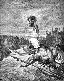
According to the Biblical account, ancient Israel established one of its great temples in the city of Dan. And here, late Neolithic people first settled as early as 4500 B.C.E., and Bronze Age inhabitants constructed the world’s oldest known gated archway.

Known today as Tell el-Qadi, more popularly as "Tel Dan", the site is located near Mount Hermon in Northern Israel adjacent to one of the sources of the Jordan River. The 'Tel', or mound, was defined very early on during the Middle Bronze period when massive defensive ramparts were constructed, encircling the city.
One of the iconic ramparts (now ruined) of Dan

Although the ramparts rise about 20 meters from the surrounding surface area, the interior of the site is actually as much as 10 meters lower than the tops of the ramparts. It was first identified based on historical records as the city of Laish, a town allied with the Phoenician Sidonians and later renamed "Dan" after the early Isrealite tribe of Dan, which conquered and settled it as documented in the Book of Judges.

Thanks to a bilingual Greek and Aramaic inscription found at the site in 1976, this city name has been confirmed. Translated, that inscription reads, “To the God who is in Dan, Zoilos made a vow.”

Ancient Egyptian texts and cuneiform tablets from Mesopotamia document Dan’s significance during the second millennium B.C.E.  Later, during the Iron Age, Aramaeans, Israelites, and Assyrians fought over this city. Dan was a recognized cultic center even into the Greco-Roman period.

Although the site was first identified by Edward Robinson in 1838, the best known excavations of the site began in 1966 under the late Israeli archaeologist Avraham Biran, and it was under his direction that the most spectacular discoveries were made. His team of excavators uncovered a mud-brick city gate (pictured right) dated to around 1750 BCE (the Middle Bronze period), the time of the Biblical patriarchs.

It is popularly known as Abraham's gate because, according to the Biblical account, Abraham journeyed to Dan to rescue his nephew Lot. They also uncovered an Israelite temple, thought by Biblical scholars to be the temple built by Jeroboam, King of Israel after the United Monarchy split into Israel in the north and Judah to the south.

It was this temple where, according to the Bible, he housed the golden calf and challenged the temple in Jerusalem as a religious center of Israel. Additionally, an elaborate Israelite gate was discovered, consisting of an upper gate and a lower gate, each featuring inner and outer gates and plazas.

Arguably the most sensational find, however, was the discovery of parts of a basalt stone stele bearing an inscription containing a declaration by a king of Damascus (possibly Hazael, c. 840 BCE, or Ben-Hadad, c. 802 BCE). Translated, it proclaims his military victory and destruction of at least some parts of the Kingdom of Israel, and the killing of two kings of Israel.

Notably, it contains the phrase "House of David" ["......and I killed [Ahaz]iahu son of [Jehoram kin]g of the House of David"], a phrase rarely, if at all, seen in any extra-biblical context. Today, many Levantine archaeologists and scholars agree that it refers to a royal dynasty of David and that the Tel Dan Stele therefore represents tangible evidence that there was indeed a "kingdom", or royal dynasty, of David.

For more pictures and information, they are available here

Greatest Mystery of Incans was their Strange Economy:

I'd like to keep this part short. This is an extract from this article (Greatest Mystery of the Incans), follow the link for more information if you'd like.

In the fifteenth and sixteenth centuries, the Inca Empire was the largest South America had ever known. Centered in Peru, it stretched across the Andes' mountain tops and down to the shoreline, incorporating lands from today's Colombia, Chile, Bolivia, Ecuador, Argentina and Peru - all connected by a vast highway system whose complexity rivaled any in the Old World. Rich in foodstuffs, textiles, gold, and coca, the Inca were masters of city building but nevertheless had no money.

In fact, they had no marketplaces at all.

The Inca Empire may be the only advanced civilization in history to have no class of traders, and no commerce of any kind within its boundaries. How did they do it?

Many aspects of Incan life remain mysterious, in part because our accounts of Incan life come from the Spanish invaders who effectively wiped them out. Famously, the conquistador Francisco Pizzaro led just a few men in an incredible defeat of the Incan army in Peru in 1532. But the real blow came roughly a decade before that, when European invaders unwittingly unleashed a smallpox epidemic that some epidemiologists believe may have killed as many as 90 percent of the Incan people.

Our knowledge of these events, and our understanding of Incan culture of that era, come from just a few observers - mostly Spanish missionaries, and one mestizo priest and Inca historian named Blas Valera, who was born in Peru two decades after the fall of the Inca Empire.

Scientists say Shroud of Turin was created by ultraviolet lasers!

Perhaps the jaw-dropper headline of the Archaeology world, certainly no one was prepared to hear this!
The shroud of Turin (positive and negative comparison)

The exact origins of the Turin Shroud remain a great mystery, but scientists are now disputing the long-held belief that the religious artifact is a medieval forgery.

Italian researchers at the National Agency for New Technologies, Energy and Sustainable Economic Development say they believe the image was created by an ultraviolet "flash of light." However, if that theory is true, it remains a mystery as to exactly how that technology could have been implemented at the time of the Shroud's creation. While the technology is readily available in present day, it was far beyond the means of anyone around pre-20th Century.

The Turin Shroud is said to be the burial cloth of Jesus, but has long been believed to be a fake, created during medieval times. It is currently kept in a climate-controlled case in Turin cathedral. Scientists at the Italian agency have reportedly spent years attempting to recreate the Shroud's imagery.
'The results show a short and intense burst of UV directional radiation can colour a linen cloth so as to reproduce many of the peculiar characteristics of the body image on the Shroud of Turin,' the scientists said.

"When one talks about a flash of light being able to color a piece of linen in the same way as the shroud, discussion inevitably touches on things such as miracles," said Professor Paolo Di Lazzaro, who led the study. "But as scientists, we were concerned only with verifiable scientific processes. We hope our results can open up a philosophical and theological debate."


Believers in the Shroud say it contains the image of a man with nail wounds to the wrist and feet. Still, skeptics of the Shroud's authenticity are unlikely to be swayed. There has been substantial evidence working against it, including a 1988 radiocarbon test conducted at the University of Oxford, which dated the cloth to a time between 1260 and 1390.

Infamous 'Yeti Finger' is a Fraud:

A finger long claimed to be from a yeti, once revered in a monastery in Nepal and taken in the 1950s by a Bigfoot researcher, has been identified after decades of mystery. Turns out, it's just a regular old human finger — albeit one with a very interesting history.
The Mysterious Finger (photo from the Daily Mail)

The yeti is said to be a muscular beast weighing between 200 and 400 pounds and covered with dark grayish or reddish-brown hair. As in the case of its North American counterpart, Bigfoot, most of the evidence of its existence comes from fuzzy sightings, oversize footprints in the snow, or the occasional strand of funny-looking hair.

But there has been one interesting piece of physical evidence of the yeti: a finger that was either bought or stolen from the Pangboche Buddhist monasteryin the 1950s, depending on which disputed story you believe. It has been in London, among the collection of the Royal College of Surgeons, for more than half a century.

The finger was taken from the monastery by Bigfoot researcher Peter Byrne and was smuggled out of the country, so the story goes, by beloved Hollywood actor Jimmy Stewart, who hid it amid his wife's lingerie. The monstrous finger ended up in the possession of Dr. William Osman Hill, who had searched for the yeti in the 1950s on behalf of Texas millionaire Tom Slick; Hill later bequeathed the finger to the Royal College of Surgeons.

The finger has generated controversy among Bigfoot and yeti believers for decades and, until relatively recently, when researchers at the Edinburgh Zoo performed DNA analysis on the mysterious digit, it was impossible to know for certain what kind of animal it belonged to. [Mythical Beasts That Might Actually Exist]

If it is indeed a Yeti finger, then the mysterious beast is even more man-like than anyone imagined. According to the researchers' DNA analysis, the Yeti finger is human, perhaps from the corpse of a monk. But definitely human.
Rob Ogden of the Royal Zoological Society of Scotland explained to BBC News: "We had to stitch it together. We had several fragments that we put into one big sequence, and then we matched that against the database and we found human DNA." The researchers said that the result “wasn’t too surprising, but obviously slightly disappointing.”

It is not the first yeti claim to be debunked by science. In 1960 Sir Edmund Hillary, the first man to scale Mount Everest, searched for evidence of the beast and found a "scalp" that scientists later determined had been fashioned from the skin of a serow, a Himalayan animal similar to a goat.

Earlier this year a team of researchers in Russia claimed to have found "indisputable proof" of the yeti, though so far the evidence has fallen far short of the claims. If populations of yetis really exist, they, like Bigfoot, have somehow managed to avoid leaving any physical traces of their presence: bodies, bones, teeth, hair, or anything else.

NATO: Libyan Heritage Sites survive because of "No Strike" list:

Earlier this week (actually, two days ago), NATO released a report about its operations in Libya with regards to the UNESCO heritage sites, claiming that the sites were relatively unscathed from the Libyan Civil War,due to a strict 'No Strike' list adopted by the military alliance.

The report says:
During the conflict in Libya there were allegations that pro-Qadhafi troops and missiles were being hidden in the ancient city of Leptis Magna and that Qadhafi was using it as an archaeological shield.
With such explosive storage, the risk of damage was great, but the sites of Leptis Magna and Sabratha have survived the conflict unscathed. That is excellent news for the cultural heritage of Libya and the tourism industry that the nation hopes to resurrect.
Conflict is not the only threat to ancient artefacts. There is also the risk that a breakdown in law and order can give criminals the opportunity to steal items of great significance. In perhaps the worst case of looting during the conflict, nearly eight thousand ancient gold, silver and bronze coins, as well as a small number of artefacts, were stolen from a Benghazi bank vault.
In some areas documentation, archiving and cataloguing was never carried out, making it difficult to estimate the loss to Libya’s cultural heritage. But, by and large, Libya seems to have avoided the kind of cultural looting and vandalism that occurred after the invasion of Iraq.
In a first of its kind initiative, two men were instrumental in setting up a ‘No Strike List’ of heritage and cultural sites that should be preserved in the conduct of air operations. They were Karl Von Habsburg, President of the ‘Blue Shield Committee’ in Austria and Dr Joris Kila, teacher at the University of Amsterdam and Chairman of ‘The International Military Cultural Resources Work Group’.
They have now returned to make an assessment of the damage inflicted by the conflict on Libya’s heritage. “We both know the importance to be fast and in a place where there is a potential conflict or an actual conflict,” says Karl, “you have to be there really fast to make an assessment and to see what you can do to immediately help.”
The two have been granted special access to sites that several months earlier had been welded shut for protection, a practice both experts agree is critical to protect heritage in times of unrest. While it works for museums, protecting sites like Leptis Magna and Cyrene in wide-open spaces is a lot more difficult.
The work they are undertaking fills the gap in the protection of heritage sites until the Libyan Government is able to take over. “We hope that we will encourage them to take over part of our duties,” says Joris, “and do the work that has to be done.
Some of the sites they visited had been in close proximity to air strikes and escaped with only cosmetic damage. “It seem like our no strike list with cultural sites was very effective,” Joris notes, “because we didn’t find serious damage with bombardments by NATO on cultural sites.”
Libyan archaeologists and historians can now breathe a sigh of relief that their heritage is still safe and secure.

2,000-year-old relief bust found in Stratonikeia, Turkey:

A picture of the bust (Photo from AA)

A 2,000-year-old relief bust of a king was discovered during excavations in ancient Stratonikeia in Muğla's Yatağan district.
Dr. Bilal Söğüt, a professor of archeology at Pamukkale University and head of the excavations, told the Anatolia news agency that they found a street in the ancient city which began with a gate and was lined with columns. During their excavations, they also discovered the bust of a king dating back to the Hellenistic period. The bust, which is one-and-a-half meters tall and nearly two meters wide, features depictions of bull heads and the figure of a goddess, Söğüt said.


The depictions of bull heads on the bust represent wealth and power. It was in this region that we previously found a racing chariot. The discovery of 1,500-year-old mosaics here was another welcome breakthrough for us,” he said.


According to Söğüt, the city walls constitute an important part of the excavation work carried out in the ancient city. “The city walls were restored approximately 2,400 years ago by King Mausolus. We have begun excavating these 2,400-year-old walls of this ancient city. Upon the completion of the excavations, we will start work on restoring the area,” he said.

Söğüt said he thinks the walls surrounding the ancient city are nearly 3,600 meters long.

“We discovered that one 400-meter section of wall has been preserved to this day. After completing restoration, we will open the wall to visitors," Söğüt said.

A 100-person team of academics, field workers and students discovered 460 artifacts in the ancient city in the seven-month-long excavations that took place last year, according to Söğüt. The artifacts were delivered to the Muğla Museum. The pieces date back to the Roman and Byzantine periods, he said.

Civil War-era wreck off Egmont Key to become preserve:

A Civil War-era ship that participated in one of the nation's most famous naval battles before sinking in the mouth of Tampa Bay is set to become Florida's 12th underwater archaeological preserve.

The wreck of the USS Narcissus tugboat off Egmont Key just north of Anna Maria Island "provides not only a fascinating underwater preserve to explore, it also offers a unique and adventurous look into our nation's naval history," Florida Secretary of State Kurt Browning said this week in announcing the nomination.
A part of the wreckage (Photo from Herald Tribune)

Built in East Albany, N.Y., in 1863, the Narcissus steamed south in January 1864 to support the Union Navy's blockade of Confederate shipping routes, according to a report complied by state researchers.
The ship was involved in operations from New Orleans to Pensacola, but its most famous engagement came during the Battle of Mobile Bay on Aug. 5, 1864.

The union fleet's victory at Mobile Bay captured a key Confederate port and lived on in popular culture thanks to the "Damn the torpedoes!" command attributed to Rear Adm. David G. Farragut as he urged his ships forward against an array of defenses.

The Narcissus was ordered to return north for sale after the war but sank in 1866 off Egmont during the journey, killing the entire crew. Once almost completely buried in sand, the shipwreck reemerged in recent years about 15 feet below the surface, according to the state report.

A 2006 archaeological expedition reported "all of the steam machinery, propeller, propeller shaft, pillow block, boiler pieces, and a portion of the wooden hull were exposed."

Lovers' Pipe Dreams Emerge from Jerusalem Excavation:

An interesting find from Jerusalem, once again !

The pipe, in all its glory !
An archaeological excavation in the Jewish Quarter of Jerusalem has uncovered a centuries-old clay pipe inscribed with the phrase "Love is the language for lovers."

Literally translated, the inscription reads "Heart is language for the lover." And, not surprisingly, it was most likely a gift to a lover, according to Shahar Puni, of the Israel Antiquities Authority.

"Clay pipes of this kind were very common in the Ottoman period, were mostly used for smoking tobacco, and some were even used to smoke hashish," Puni said in a statement. Hashish comes from the cannabis plant, like marijuana.

During this period, from the 16th to the 19th century, Jerusalem was part of the vast Ottoman Empire, a Turkish state that reached into Asia, Africa and Europe.

"The Ottoman authorities tried to combat this practice [smoking] but failed when it became clear that smoking was firmly entrenched in all levels of society. Pipes were also used as a piece of jewelry that could be worn on a garment, and smoking itself was popular amongst both men and women," Puni said.

Jerusalemite women are shown smoking clay pipes similar to this one in 19th-century drawings. Smoking was often done in cafes and with groups of friends, according to the Israel Antiquities Authority. 
_________________________________________________________________________________

And that's a wrap up for this Friday. See you next Friday !

Update:
Just hot off the presses and I thought it would be worthwhile to share.

Financial Crisis grips Bosnia Heritage sites:

To the average history-buff, it is of no doubt that Bosnia houses some of the wonders of the Balkan region (and has seen way more than its fair share of turmoil ). This from the BBC:

Reading rooms in Bosnia-Hercegovina's National Library have opened without heating as a funding crisis grips the divided country's heritage sites.

The institution in the capital Sarajevo is unable to meet its utility bills or pay its staff, deputy director Bedita Islamovic told the BBC News website.

Heating was switched off as the temperature hovered just above zero.
Other cultural institutions have closed completely as a result of disagreement over who should pay for their upkeep.

The Dayton peace agreement which ended the 1992-95 war split the country into two parts, linked by a weak central government.

The central government has no ministry of culture and no obligation to provide permanent funding for sites regarded as part of Bosnia-Hercegovina's national heritage.

Bosnian Serbs largely oppose giving the central government control over the sites, with their politicians arguing that each of the country's ethnic groups should care for its own heritage.

Bosnia's cultural breakdown

  • No central culture ministry
  • Bosniak-Croat Federation has a culture and sports ministry
  • Bosnian Serb Republic has an education and culture ministry
So deep are the continuing divisions that it has taken the sides 14 months to agree on the make-up of a new central government, after elections in October 2010.

This week, the Historical Museum closed and the National Gallery shut its doors early in the autumn.
The National Museum expects to close piece by piece in coming weeks as its power supply is cut off due to unpaid bills, director Adnan Busuladzic told the Associated Press news agency.

"By no will of our own, we have found ourselves in the middle of a political battle and have become a political problem," he said.

Among other things, the National Museum's collection includes the Sarajevo Haggadah, an illuminated manuscript brought to Bosnia by a Jewish family expelled from Spain during the Inquisition and saved from Hitler's forces during World War II.

The culture minister of the country's Bosniak-Croat Federation, Salmir Kaplan, reportedly pledged his government would provide funding to cover the unpaid utility bills of the National Museum.
However, he admitted this was just a temporary solution, AP says.

The Bosnian Serb Republic (Republika Srpska) has a culture ministry of its own.