Maps etiketine sahip kayıtlar gösteriliyor. Tüm kayıtları göster

7 Haziran 2020 Pazar

The Most Thorough British Intelligence Maps of Bahrain - 1937

The Most Thorough British Intelligence Maps of Bahrain - 1937

In 1937, elements of the British Admiralty's intelligence division published a series of map of the Arabian Peninsula providing a survey of significant urban locations. These maps typically covered British protectorates and especially locations with military installations such as Bahrain (which hosted bases for the Royal Navy, Airforce and Army respectively).

As a result, these maps provide some of the most comprehensive surveys of Bahrain prior to the unsustainable land reclamation that engulfed the island nation in the latter half of the 20th century and the present day. Particular highlights include the shallow reefs (now largely reclaimed), representation of villages outside the urban hubs of Manama and Muharraq which are rarely represented.

Double click for a larger size (original file here enables better zoom via QDL)

Accompanying this is another map surveying pre-independence Manama, in particular when the city was host to its own harbour (the Manama pier) before it was relocated in the 1960s to Mina Salman in the south. This map also highlights notable sites in the city including the two hospitals of Victoria and Mason Memorial Hospitals as well as the houses of many contemporary notables in Manama.

Higher resolution image from the QDL

1 Haziran 2018 Cuma

A Study of Bahrain in Old Maps

A Study of Bahrain in Old Maps

One of the many ways we can perceive and analyse the past is through depictions of contemporary geography onto maps. Cartography (the study of maps) has long helped historians understand and appreciate how peoples and empires perceived themselves in their time. And, more often than not, they were the centre of their own universes

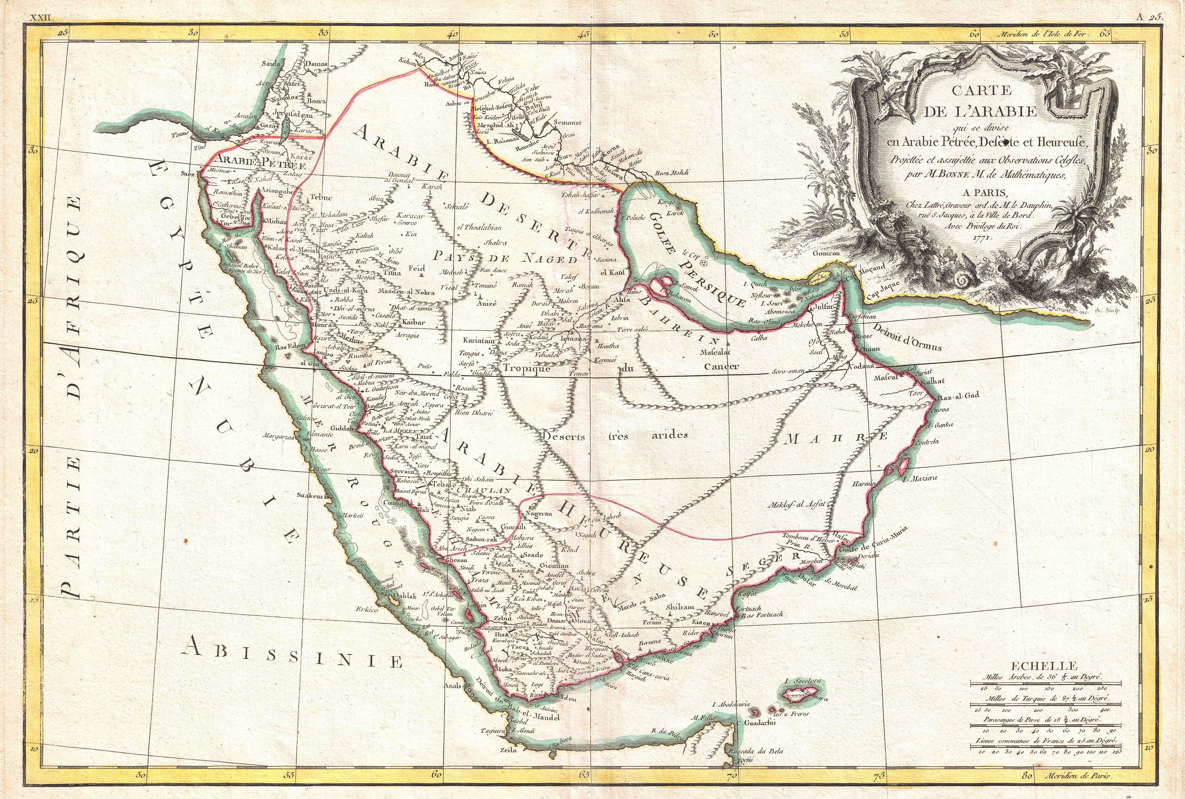
Historically & up to the 18th century, Bahrain referred to the eastern shores of Arabia, an area that currently encompasses Kuwait, eastern Saudi Arabia, Bahrain, Qatar, the United Arab Emirates and parts of northern Oman. The German map, made by Jacques-Nicolas Bellin, below from 1745 lays testimony to this. 

Note the Bahrayn region of the eastern Arabian coastline (Jacques-Nicolas Bellin, 1745)

Other interesting maps of Bahrain throughout the ages that I could find and appreciate are the following. All of these have been found, scanned and uploaded by the Qatar Digital Library (which is doing an incredible job at documenting and preserving primary source historical documents of the Persian Gulf)

Trigonometrical Map of the Island of Bahrain, 1828.
This splendid map was produced by James Horsburgh, Hydrographer to the East India Company in 1828. This map's title features in a decorative cartouche with a view of ‘A Mosque on Bahrein. From a rough sketch by Dr. A. Mackell’, with the mosque in question being the Khamis Mosque (the oldest mosque in the country, dating back to the 7th century AD). Other prominent locations mentioned include the ‘Portuguese lighthouse, harbour and fort’, west of Manamah.

The engraver’s details inserted below a compass rose orienting north at the right centre of the map. Nautical chart of the western coast of the Persian Gulf showing the Island of Bahrein compiled from the surveys carried out by the Bombay Marine’s officers between 1820 and 1829.

Originally posted in the Qatar Digital Library

Imperial Airways Flight Path of Bahrain, 1937.
This map was made in 1936 and edited in 1937, published by the UK Admiralty. Imperial Airways (the predecessor of British Airways) planned to introduce flying boat services to the region, including Bahrain. This map was utilised as a means of assessing the various seaborne approaches to Bahrain Harbour and Khor Kaliya [Khawr al Qulay‘ah]. The map shows Bahrain island and the surrounding sea. It includes soundings in fathoms with supplementary depth contours, and highlights features to aid the navigator. The map also outlines Manama and Muharraq and details buildings (prominent buildings being labelled).

Manuscript additions to the map have been included. Red additions outline the proposed alighting area, the proposed location of moorings, and a proposed location for a passenger shelter. It also includes the location of the pre-existing Royal Air Force (RAF) pier. Navigation beacons have been highlighted in orange. The Imperial Airways Landing Ground has been highlighted using pencil.

Originally published on the Qatar Digital Library

Map of Muharraq and the New Airport, 1937
This map was drawn up in 1937 when the British Political Residency in Bahrain intended on establishing a civilian aircraft landing strip for Imperial Airways (in addition to the sea landings that were to be conducted).. This map shows Muharraq Island, and the causeway linking Muharraq to Manama. Also shown are principal roads, tracks, buildings (including the Political Agency in Manana), islands, and the location of several underwater freshwater springs. A rectangle on Muharraq Island indicates the area specified for the landing ground, which would later become the current Bahrain International Airport.

What I specifically like about this map is that it shows the original villages of Muharraq island including Arad, Hidd, Samaheej, Dair, Galali and Busaiteen on their own and isolated (which is very different to what we currently see them as). First posted on the Qatar Digital Library

Bahrain Saudi Maritime Border, 1939
Dated 29th May 1939 and drawn up with regards to Saudi claim to certain islands, this detailed sketch map was prepared by the Bahrain Petroleum Company from Admiralty charts. It shows  Bahrain, the Saudi Arabian and Qatari coasts and the waters to the north, with shoals and reefs mapped in detail. New information obtained during a reconnaissance survey between 25th and 27th May 1939 were added in red ink including the proposed boundaries line to determine territorial waters of Saudi Arabia and Bahrain.
Originally posted in the Qatar Digital Library

Artesian Water Supply in Bahrain, 1948
This is fairly straightforward. In 1948, at the request of the Government of Bahrain at the time, a map was drawn up by the Bahrain Petroleum Company showing the national distribution of artesian water wells in Bahrain. Artesian water wells are basically a well that doesn't require a pump to bring water to the surface; this occurs when there is enough positive pressure in the aquifer itself. This pressure forces the water to the surface without any sort of assistance. Famous examples of artesian wells in Bahrain include the Adhari spring, Ain Abu Zaydan, Ain Um Sujur, Ain Barbar. However, due to overutilisation of the aquifer and rapid urbanisation, many of these springs have ceased running since the 1980s. This paper by Mohammed Al-Ansari on Bahrain's water demand and subsequent management provides a good overview of the current situation and likely hurdles to be faced in the future.

Originally posted in the Qatar Digital Library.
Greetings From Bahrain! 1939
This is light hearted compared to the other ones. On the occasion of King Edward VIII's birthday in June 1939, the British political residency of Bahrain (headed by Kennard Foulkes) sent Buckingham Palace a greetings card from Bahrain. If you look past the imperialism, it's a pretty cute card. Designed by Ashraf Brothers (a well known local business), the card features important sites in Bahrain including the Shaikh's Hunting Lodge, Oil Wells, the Portuguese Fort, and Water Wells.

Originally posted here
Addendum (February 28, 2020):


A British map of Bahrain from the 1930s.

17 Haziran 2017 Cumartesi

Bilad al Qadeem in 1908 - A Brief History Of A Bahraini Village

Bilad al Qadeem in 1908 - A Brief History Of A Bahraini Village

The Gazetteer of the Persian Gulf, Oman and Central Arabia (abbreviated Lorimer, after its author) is one of the more remarkable by-products of British colonial intelligence-gathering. I've already spoken about it in great detail in prior posts but would like to re-emphasise the importance to historians (and amateur history geeks) that this document presents. It showcases a Domesday book (much like that of the Normans) written from a colonial British point of view of much of the Arabian peninsula, highlighting histories (finished in 1915) and major/minor geographical settlements  (finished in 1908) from the then-large towns of Manama and Muharraq to small hamlets spread across the plains of Arabia.

As you can imagine, I will delve into a series of posts about the entries of Bahrain's villages in the Gazetteer to appreciate an idea or snapshot of what the Bahrain of 1908 really looked like back then & in turn help understand the history of Bahrain. I will start with Bilad al Qadeem because it's literally the oldest and I feel that maybe we owe it that much.


Bilad al Qadeem
A large scattered village on Bahrain Island about 1.5 miles southwest of Manama fort. It consists of 350 mud & red huts, along with the ruins of many well-built houses. 
There is a south-western suburb called Bilad-al-Rafi (بلاد الرفيع) and the ground on the northwest side of the village, called Suq-al-Khamis (سوق الخميس), is the scene of a largely attended market which is held every Thursday throughout the year. 
About half a mile west of the existing habitations are the ruins of the Madrasah Abu Zeidan (مدرسة ابو زيدان) mosque*, with two slender and not inelegant minarets, 70 feet high, still standing; in combination with Jebel Dukhan, these minarets form the leading mark for vessels entering Manamah harbour. 
The Khamis Mosque (likely the Abu Zeidan too)
In the midst of the ruined part of the village is the Abu Zaidan spring, over which is built a modern Shia'h mosque, its beautifully clear waters fill a tank to which all the notabilities of Bahrain resort for hot bathing in the hot weather. 
The people of Bilad-al-Qadim are Baharnah who gain a livelihood as pearl merchants, cultivators and tailors. Livestock include 21 donkeys and 7 cattle. Date palms are estimated at 11,500 trees, and there are some figs, almonds and pomegranates. The rose and jessamine grow. 
*The Abu Zeidan mosque is very likely referring to the Khamis Mosque.

If you would like to read more about the history of Bilad al Qadeem (which is now a suburb of Manama, the capital city of Bahrain), the Wikipedia page is a great place to start.

This sketch map of Bahrain in 1936 shows the 'minarets' (centre), believed to stand for the minarets of the Abu Zeidan mosque of Bilad al Qadeem, which guided naval vessels to Manama port (QDL)

20 Mayıs 2014 Salı

Here Be Dragons - Except Not Really

Here Be Dragons - Except Not Really

For the uninitiated, the phrase 'Here be dragons' (immortalised by classical era fanboys as Hic Sunt Dracones in Latin) was believed to be widely used on maps by cartographers to describe dangerous and otherwise unexplored lands. This phrase would typically lie on the outline of ancient sepia maps, warning would-be travelers of the mysterious great blue yonder.

Of course, aside from a rather trivial exception, this seems to be quite inaccurate. Whilst animals have been used in the past to denote dangers of the unknown (an Anglo-Saxon map warns of lions in Africa, Ptolmey's Geographia atlas warned of elephants, hippos and even cannibals!), the only instance where dragons were mentioned by name comes from the Hunt-Lenox Globe (which is actually on display at the New York Public Library).

The Hunt-Lenox Globe (squint eyes to see Latin)
Made in 1506, this copper sphere was one of the first to be made after Columbus' expedition to the New World. Stamped on Southeast Asia , the Latin words 'Hic Sunt Dracones' lie ominously on the model. Recent commentators have downplayed the warning-aspect of the sentence, stating that the words referred to the intimidating Komodo dragons that were known to inhabit islands off the coast. [1] No doubt that stories of their ferociousness were probably the main reason as to why they were included on this map and not for the sake of medieval folklore and mythology.

Scholar Dennis McCarthy summarises the entire misconception well:
"The phrase was not, as so many believe, a general warning to sailors about alien realms. It was, instead, one of the first recorded post-Columbian biographical remarks and has now become, perhaps, the most famous distributional comment ever, likely marking the general region where tales of the Komodo dragon originated"[1]
References:
  1. Dennis McCarthy (2009). Here be Dragons – How the study of animal and plant distributions revolutionized our views of life and Earth. Oxford University Press. ISBN 0-19-954246-5.

3 Aralık 2012 Pazartesi

History in Focus: The Austro-Hungarian Empire

History in Focus: The Austro-Hungarian Empire

Well, it's been a while since we had a maps/photo-only post so here it goes!

In case you don't know, the Austro-Hungarian empire was a constitutional monarchist union between the crowns of the Austrian Empire and the Kingdom of Hungary in Central Europe. The union was a result of the Austro-Hungarian Compromise of 1867, under which the House of Habsburg agreed to share power with the separate Hungarian government, dividing the territory of the former Austrian Empire between them.

The Austrian and the Hungarian lands became independent entities enjoying equal status. Austria-Hungary was a multinational realm and one of the world's great powers at the time. The dual monarchy existed for 51 years until it dissolved on 31 October 1918 at end of World War I. Three decades after its dissolution, most of former Austria-Hungary became part of the Soviet Union or the East Bloc countries.

Extremely detailed Ethnic, Transport, and Physical map of the Austrian Empire from 1855
The realm comprised modern-day Austria, Hungary, Bosnia and Herzegovina, Croatia, the Czech Republic, Slovakia, Slovenia, large parts of Serbia and Romania and smaller parts of Italy, Montenegro, Poland and Ukraine.

Austrian troops marching up Mt. Zion, Jerusalem, 1916
Austro-Hungarian WW1 POW's in Russia, 1915
Pavilion of the Austro-hungarian Llyod at the world's fair, Vienna, 1873
1892 protests in Bucharest for equal rights for Romanians in Austria-Hungary-ruled Transylvania
Emperor Franz Joseph and Archduke Franz Ferdinand, 1908.
 Austrian officers and a dog
Autro-Hungarian dragoons
Abbazia in 1911
Thousands more photos are present on Flickr. I highly recommend it.

1 Eylül 2012 Cumartesi

Vintage Maps of the Arabian Peninsula

Vintage Maps of the Arabian Peninsula

Some rather old maps of the Arabian peninsula, details under each respective map.

It's bigger when you click it !
Embedded text: This map of the Arabian Peninsula, published in 1720, shows Arabia Felix, Arabia Deserta, and Arabia Petraea. Other regions included are Palestine, Mesopotamia, Chaldea, Persia, Aegyptus, and Aethiopia. A large number of towns are shown. The title cartouche includes nine vignette coins. The tribal and town names on the map are those used by Ptolemy. Some are used more than once, with variations. Thus “Indicara,” “Iacara,” “Ichara,” and “Aphana” all could indicate the same place: the spot where Alexander the Great intended to build a capital on an island in the Arabian Gulf, enabling him to control the trade of the region and extend his empire (a scheme that he was unable to accomplish before he died).

 Archeological research suggests that this place was Failakah Island in present-day Kuwait, although some historians place it at Abu Ali Island. The map shows a peninsula near present-day Bahrain. The islands of “Arathos” and “Thylaso” indicate Muharraq and Bahrain islands, respectively, which are actually located north of Qatar. On this map, they are placed on the Persian coast side, probably because the cartographer confused them with “Hormuz” and “Qishm.” Qatar is mentioned on the map as “Catara,” but its shape and location are not accurate. The map is by Christoph Weigel, a German engraver, art dealer, and publisher.

Embedded text: This map from Ptolemy’s Geographia was published in 1578 and reprinted on many occasions between 1584 and 1704. It is much more finely engraved than maps in previous Ptolemy editions. The map mentions several places in present-day Qatar (Abucei, Leaniti, Themi, Asateni, and Aegei). Names added to this edition of the map include Mesmites Sinus, Idicar, and a second Idicar, located in present-day Kuwait. This name is similar to the island of “Ichara” found near Magorum Sinus. Contemporary research has confirmed that Kharj is the island known to the ancients as “Icara.” 
One of the major peninsulas shown on the map is named “Chersonesi Extrema,” near Catara. Modern scholarship has identified Chersonesos as Ras Rakn in present-day Qatar. Ichtyophagorium Sinus is the gulf inhabited by the people identified in ancient histories as the “Fish Eaters.” Claudius Ptolemaeus, known in English as Ptolemy, was an ancient mathematician, astronomer, geographer, and astrologer who was born sometime after 83 A.D., most likely in a town in the Thebaid called Ptolemais Hermiou in Roman Egypt. He lived in Egypt and died in Alexandria around the year 168.

Embedded text:  This 1616 map is a reprint of a map originally published in 1598 by Jodocus Hondius (1563-1612), a Flemish cartographer and engraver who settled in Amsterdam in about 1593 and established a business that produced globes and the first large maps of the world. The map covers the territory from west of the Gulf of Suez to the eastern side of the Arabian Peninsula, and from the mouth of the Euphrates River to Aden. The only cities indicated on the western coast of the Persian or Arabian Gulf are Qatar (“Catara”), “Godo,” and “Catiffa.”

 The map shows sandbanks around the coast and rivers at Medina and Mecca. Few towns and regions are shown, and there is a range of mountains in the center of the peninsula. Al Qatif is repeated as the town “Catiffa” and the region “Elcatif.” The peninsula opposite Bahrain Island, shown unnamed, is marked as where “Catara” is found. The commonly noted rivers of the Arabian coast are shown as very close together. The Arabian Gulf is called “Persicus Sinus” (Persian Gulf) and there is no name given for the Red Sea. The Ayaman area is shown as the most populated area on the map. The cartographer uses castles to denote cities and dotted lines to show the division of the Arabian Peninsula into three parts.
(Click for larger image)
 Embedded text: A beautiful example of Rigobert Bonne's 1771 decorative map of the Arabian Peninsula. Covers from the Mediterranean to the Indian Ocean and from the Red Sea to the Persian Gulf. Includes the modern day nations of Saudi Arabia, Israel, Jordan, Kuwait, Iraq, Yemen, Oman, the United Arab Emirates, and Bahrain. Names Mt. Sinai, Mecca and Jerusalem as well as countless other cities and desert oases. Also notes numerous offshore shoals, reefs, and other dangers in the Red Sea and the Persian Gulf. There is a large decorative title cartouche in the upper right hand quadrant. A fine map of the region. Drawn by R. Bonne in 1771 for issue as plate no. A 25 in Jean Lattre's 1776 issue of the Atlas Moderne .

Embedded text: A fine example of Rigobert Bonne and G. Raynal’s 1780 map of the Arabia and Abyssinia (Ethiopia). Covers from the Nile Delta south as far as the Horn of Africa and West to Persia, inclusive of the modern day countries of Ethiopia, Egypt, Saudi Arabia, Yemen, Oman, Kuwait, the and the United Arab Emirates. Offers surprising detail considering that his part of the world was largely unknown to Europeans.

 Identifies towns, rivers, some topographical features, ports and political boundaries. Dangerous reefs and other undersea dangers that historically hindered trade in the Red Sea and the Persian Gulf are tentatively ghosted in. Drawn by R. Bonne for G. Raynal’s Atlas de Toutes les Parties Connues du Globe Terrestre, Dressé pour l'Histoire Philosophique et Politique des Établissemens et du Commerce des Européens dans les Deux Indes .

(Click for larger image)
 Embedded text: A particularly interesting historic map, this is Karl von Spruner’s 1865 rendering of Arabia, Aethiopia (Ethiopia) and Egypt (Aegyptus) in antiquity. Centered on the Red Sea or Mare Rubrum , this map covers the entirety of the Arabian Peninsula, the Persian Gulf, and the Nile Valley as far south as Lake Tana (Pseuba), the source of the Blue Nile. Like most of Spruner’s work this map overlays ancient political geographies on relatively contemporary physical geographies, thus identifying the sites of forgotten towns and villages, the movements of armies, and the disposition of lands in the region. This particular example includes both ancient Latin and more contemporary Arabic names (transliterated of course) for many important regions and sites.

 Additionally, two inset maps are offered. In the lower left hand quadrant a map labeled “Heptanomis et Thebais” focuses on the course of the Nile from Heptatnomis (near Fayum) south to just past modern day Aswan, covering in the process many of the ancient Egyptian cities now submerged under the waters of Lake Nasser. Another inset, in the upper right quadrant, focuses on the fertile Nile Delta, forming an inverted triangle between Alexandria, Memphis, and Casluch. As a whole the map labels important cities, rivers, mountain ranges and other minor topographical detail. Territories and countries outlined in color. The whole is rendered in finely engraved detail exhibiting the fine craftsmanship for which the Perthes firm is known

(Click for larger image)
 The Arabian Peninsula by Nicolaus Germanus in 1467

Map of the location of Arab tribes in 600 AD
(Click for larger image)
  • Title:Arabia Felice Nuova Tavola
  • Made in Venice
  • FIRST EDITION 1561
  • SIZE 18.0 x 24.7 cms
  • TECHNIQUE Copper engraving
(Click for larger image)

Embedded text: Map of Persia and Arabia from J. H. Colton’s 1855 Atlas of the World. Covers Afghanistan, Iran, Iraq, Jordan, and the Arabian peninsula ( Saudi Arabia, Yemen, Kuwait, United Arab Emirates, and Oman). Map is a lithograph from a steel plate engraving. Details desert trading routes, oases, trading centers, etc. Beautiful hand color