As always, the realm of archaeology has been bustling this past week and here's the lowdown:
Archaeologists Uncovering the Heart of Ancient Aelia Capitolina:Recent excavations by a team of archaeologists just west of Jerusalem's famous Western Wall and Plaza are illuminating scholars while raising new questions about 2nd Century AD Jerusalem.
Under the directorship of Shlomit Weksler-Bdolah, Alexander Onn, Shua Kisilevitz and Brigitte Ouahnouna of the Israel Antiquities Authority, the systematic excavations were conducted between 2005 and 2010 and revealed a major Roman-constructed thoroughfare that sliced through the heart of 2nd century Jerusalem, the period that followed the downfall of the First Jewish Revolt and saw the transformation of the city into a newly Romanized city, renamed Aelia Capitolina.
A detailed article about their discoveries has been published in an article entitled
Layers of Ancient Jerusalem in the January/February 2012 issue of Biblical Archaeology Review. This article relates the results thus far of excavations that progressed as far down as the underlying 8th century B.C.E. quarry used by stone cutters to produce the well-known limestone building blocks used to construct much of ancient Jerusalem's monumental structures.
 |
| A model of a typical Israelite house during the First Temple period |
Just above that quarry, the archaeologists also found part of what has been interpreted as a large "four-room" house laid out in a style typical of Israelite house structures of the First Temple period, featuring three long, parallel rooms and a larger room extending perpendicularly across the ends of the other three (see model example pictured right).
Within the structure was found several personal seals (small round or elliptical incised pieces of clay used, for example, to sign and seal ancient correspondence) bearing Hebrew names.
Within its dirt fill were hundreds of pottery shards and fragments of clay zoomorphic and anthropomorphic figurines, all dated to the latter part of the First Temple period, between the 8th and 6th centuries B.C.E. The archaeologists suggest the likelihood that the structure was destroyed by the Babylonians in 586 B.C.E., along with the rest of the city, but lack of evidence of any fire normally associated with the Babylonian destruction raises other possibilities, such as an earthquake.
In any case, the team suggests that the structure represents a house that was inhabited by members of Judah’s social elite, as evidenced by the seals, and that other material found within the house indicate a possible cultural connection to Assyria.
If you are interested in the topic, you can read more
here.
Mystery of Pompeii's Trashy Tombs Explained:
The tombs of Pompeii, the Roman city buried by a volcanic eruption in A.D. 79, had a litter problem. Animal bones, charcoal, broken pottery and architectural material, such as bricks, were found piled inside and outside the tombs where the city's dead were laid to rest
To explain the presence of so much garbage alongside the dead, archaeologists have theorized that 15 years before the
eruption of Mount Vesuvius, an earthquake left Pompeii in disrepair.
However, this theory is unlikely, according to an archaeologist who says the citizens of Pompeii may have just been messy, at least by modern, Western standards.
"We tend to assume things like that are universal, but attitudes toward sanitation are very culturally defined, and it looks like in Pompeii attitudes were very different than ours," said Allison Emmerson, a graduate student studying Roman archaeology in the classics department of the University of Cincinnati.
 |
| Composite photo, showing why tombs were filthy(Photo from Porta Stabia |
Archaeological evidence from the last 15 years indicates that the city likely did not fall into ruin after the earthquake in A.D. 62; rather than flee, citizens appear to have rebuilt, reconstructing public spaces and elite houses.
When the eruption buried the city, new tombs were still being built and the city appeared prosperous, according to Emmerson.
"It just didn’t make sense that trash would mean the tombs weren't being used," she said.
In fact, the tombs weren't unique; excavators have found the same sort of household garbage in the city streets, along the walls of the city, even on the floors of homes.
When Emmerson excavated a room in a house that appears to have also served as a restaurant, she found a cistern for storing water between two garbage pits packed with broken pottery and food waste, such as animal bones, grape seeds and olive pits.
No evidence has been found for a system for handling garbage or for dedicated dumps.
"The closest thing that has been found is a giant heap of garbage outside the city walls," she said.
The
residents of Pompeii also appear not to have shared our conventions on burial. As Romans, they were primarily concerned with being remembered after death, so they sought tombs in high-traffic areas. Since Roman law and custom forbid cemeteries inside the city, the tombs ringed the city walls, and clustered at its gates.
The walls of the tombs also served as the billboards of the day, bearing official graffiti announcing gladiator fights, and political advertisements for candidates for office in red paint. Other
graffiti was of the "bathroom" variety, Emmerson said. These included more obscene versions of "I had a girl here," and messages back and forth scratched into the plaster of the tombs.
Emmerson is scheduled to present her work, which examines how Pompeii's tombs reflect the culture at the time, on Saturday (Jan. 7) at the annual meeting of the Archaeological Institute of America in Philadelphia.
Ancient Capital of Cambodia Wilted When Water Ran Low:
Angkor, the ancient city in Cambodia that was the seat of the Khmer empire, flourished from the 9th to the 15th century. Today, tourists still appreciate the remnants of its architecture and sophisticated hydro-engineering systems, composed of canals, moats and large reservoirs known as barays.
Researchers now studying sediments from one of the reservoirs report that prolonged droughts and overuse of the soil may have interfered with Angkor’s water management system and led to the empire’s decline.
“When Angkor collapsed, there was a drop in water levels,” said Mary Beth Day, an earth scientist at the University of Cambridge in England. “And much less sediment was delivered to the baray at the time.”
Angkor’s population may have been growing, and the soil may have been stressed from aggressive use, she said.
“The sediment being delivered to the reservoir during Angkor times was more weathered than the sediment being delivered post-collapse,” she said. “The land was used fairly aggressively for agriculture, as opposed to when people left.”
Ms. Day sampled six and a half feet of sediment core from Angkor that allowed her to study its physical properties, like the abundance of various elements and the ratio of sand to finer-grained materials.
She and her colleagues
published their research in the current issue of
The Proceedings of the National Academy of Sciences.
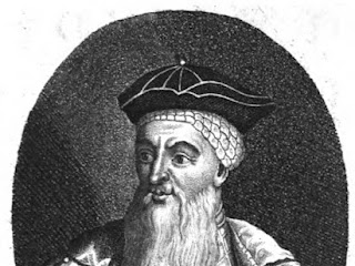
Yarrow is King Arthur’s final resting place – archaeologis:
The Yarrow Stone marks the grave of King Arthur, a literary archaeologist claimed this week!
 |
| The alleged grave of the semi-legendary King Arthur |
Damian Bullen said there was a consensus among academics that the Liberalis Stone (another name for the Yarrow Stone) was the burial ground of two Christian princes who reigned in the fifth and sixth centuries AD – and one of those, he believes, was King Arthur.
Mr Bullen, 35, of Edinburgh, said: “When we strip away the mediaeval romancing of our legendary king, we are left with genuine nuggets of historicity. One of them is the stone at Yarrow which I am convinced is his grave marker.”
The famous monarch is reputed to have died with his nephew, Mordred (Medrawt), in a crooked glen, which Mr Bullen said matches the river bends in the Yarrow Valley near the Liberalis Stone.
Ploughing in the area 300 years ago revealed a large flat stone inscribed in Latin, saying it was a memorial to “
the most famous princes Nudus and Dumnogenus. In this tomb lie the two sons of Liberalis”.
Mr Bullen went on: “At first glance it seems that Prince Nudus and Prince Dumnogenus were the sons of King Liberalis, but there is more to these names than meets the eye.
“Calling our two princes ‘sons of Liberalis’ would be a poetic way of saying that they were very noble princes (and) in the context of a burial chamber, the word Nudus (which implies loss of one’s material possessions) is surely used as a deterrent to would-be grave robbers.”
He suggests Dumnogenus, instead of being a prince, means ‘born of the Dumno’, which he takes as referring to the Dumnonii tribe of ancient Britons in Cornwall, Devon, Somerset and Dorset.
“This knowledge renders the inscription as, ‘Here lie two famous and very noble princes of Dumnonia, buried without possessions’. Of all the princes of antiquity who have heralded from this region, there is one who stands head and shoulders above all the rest – King Arthur. That he died with a family member – Mordred – fits the inscription on the Yarrow Stone completely.”
He claimed the monks of Glastonbury, where some believe Arthur to be buried, made the story up to raise money.
Mr Bullen notes there are battlefield burials in the area and he suspects Arthur’s corpse was the well-preserved skeleton found on Whitehope Farm in the mid-19th century, but which was gradually lost to curio-seekers.
And from letters dating back to the period, the literary archaeologist also thinks King Arthur’s skull may be in the vaults of a local museum.
Asked to comment on Mr Bullen’s hypothesis, Selkirk historian Walter Elliot said: “Mr Bullen has certainly researched the Yarrow Stone and the various stories about Arthur very well. Whether the two can be joined together is a matter of question.
“Arthur, if he existed, was never a king, but the war leader of the Christian Welsh speakers against the pagan Anglo-Saxons, and the Yarrow Stone is on the linguistic division between the two languages. So far, so good. Arthur is claimed as a local hero from Orkney to the Continent and his graves are many. This is a tricky subject."
Slaves or not, Babylonians were like us, says book:
 |
| One of the tablets used in the book. |
They got married, had children, made beer. Although they lived 3,500 years ago in Nippur, Babylonia, in many ways they seem like us. Whether they were also slaves is a hotly contested question which Jonathan Tenney, assistant professor of ancient Near Eastern studies, addresses in the newly released "Life at the Bottom of Babylonian Society: Servile Laborers at Nippur in the 14th and 13th Centuries, B.C." (Brill).
The book is based on Tenney's dissertation at the University of Chicago, for which he received the 2010 Dissertation of the Year Award by the American Academic Research Institute in Iraq.
Some previous scholars identified the 8,000-strong group of government workers as temple employees. "
But the problem is the records included food for little babies, which didn't make much sense," says Tenney, who joined the Cornell faculty this past fall. "
And sometimes the workers ran away, and when they were captured they were put in prison."Tenney translated more than 500
cuneiform tablets in his hunt for the truth about these weavers, musicians, "water sprinklers" and others in service to the governors of Nippur. By using quantitative measurements to create
demographic data, he was able to look at
population dynamics, family structure and the legal status of this population. He then compared the Babylonian group's demography with other better-studied groups, such as those in Roman Egypt, medieval Tuscany and on American slave plantations.
"Whether they're slaves is not what's valuable to me about this work," Tenney says. "The point is we don't have an historical demography of Babylonia at all. We don't even know how many people were living there at any given time." His book is the most detailed study yet done of any population group in Babylonia.
The picture Tenney draws of family life in this servile population is surprising in its mundanity. By far the majority of households were nuclear, husband-wife-children or a
single parent with children, usually a widow, instead of slaves living together or in groups. Tenney was able to track some families for as long as 32 years.
"As you start to work with slavery you realize how many misconceptions we have," he says. "Being a slave doesn't necessarily mean you can't have a family life and raise children and develop your own individual culture and identity. I think that slavery and freedom exist on a continuum of varying degrees." He left it to his readers to decide where the Babylonians about whom he wrote fit on that continuum.
The tablets Tenney translated were excavated by scholars from the University of Pennsylvania in the 1890s in what is now Iraq; they are some of the earliest Babylonian texts ever found. Tenney will publish the raw data from his research in the forthcoming "Middle Babylonian Administrative and Legal Documents Concerning the Public Servile
Population of Nippur."
Video of a Roman helmet's 'astounding' Restoration:Roman helmet's 'astounding' restoration |
| The helmet, after its restoration (from the Telegraph) |
A Roman helmet which was buried in a Leicestershire field for around 2,000 years has been displayed at the British Museum.
It was in hundreds of pieces when it was found in Market Harborough, in 2000, and has since been put back together.
Ken Wallace said when he discovered the helmet the metal fragments looked like "crushed cornflakes".
Mr Wallace added that he was amazed by its restoration by experts at the British Museum.
The helmet will go on show in the Harborough Museum on 28 January.
Claim of Maya ruins in Georgia sparks controversy:
A claim that the Mayans left stone ruins in the mountains of North Georgia has sparked a controversy. The claim was made by Richard Thornton, an architect, who says he has been studying the history of the native people of southeastern United States.
 |
| The now-controversial Mayan Ruins in Georgia |
According to Thornton, in an article on
Examiner.com, architects have long recognized that there are significant similarities between the architectural forms and town plans of Maya civilization in Mexico and ruins of southeastern United States.
Thornton writes that archeologists do not link the ruins in southeastern United States with Mayans of Mexico because of their "unfamiliarity with the descendants of the Southeastern mound-builders, tribes such as the Creeks, Alabamas, Natchez, Chitimachas and Choctaws."
Thornton claims there is a link between the ancient Mayans and the indigenous people of Georgia. He argues that the languages "of the Creek Indians contain many Mesoamerican words." Thornton's thesis is that when the Maya civilization declined in Central America, at least part of the population migrated to Georgia in southeastern U.S.A. He writes on
Examiner.com:
"Historians, architects and archaeologists have speculated for 170 years what happened to the Maya people. Within a few decades, the population of the region declined by about 15 million. Archaeologists could not find any region of Mexico or Central America that evidenced a significant immigration of Mayas during this period, except in Tamaulipas, which is a Mexican state that borders Texas on the Gulf of Mexico. However, Maya influence there, seemed to be limited to a few coastal trading centers. Where did the Maya refugees go? By the early 21st century, archaeologists had concluded that they didn’t go anywhere. They had died en masse."
Thornton claims that the conclusion by archaeologists that the Mayans "didn’t go anywhere, they died en masse," is wrong. He claims that a 1,100-year-old archeological site near Georgia's highest mountain Brasstown Bald, is the fabled Mayan city of Yupaha the Spanish explorer Hernando de Soto, searched for unsuccessfully in 1540. He writes:
"The name of Brasstown Bald Mountain is itself, strong evidence of a Maya presence. A Cherokee village near the mountain was named Itsa-ye, when Protestant missionaries arrived in the 1820s. The missionaries mistranslated 'Itsaye' to mean 'brass.' They added 'town' and soon the village was known as Brasstown. Itsa-ye, when translated into English, means 'Place of the Itza (Maya).'”
Thornton cited the work of an archeologist Mark Williams, of the University of Georgia. The archeologist reacted to the article and posted a comment on the article page on Examiner.com:
"I am the archaeologist Mark Williams mentioned in this article. This is total and complete bunk. There is no evidence of Maya in Georgia. Move along now."
But Mayan history and archeology enthusiasts who had taken interest in Thornton's claim, apparently in connection with the Mayan 2012 apocalyptic prophecies, took exception to Williams ticking off Thornton.
In the
comments section of the article, someone criticized Williams, saying: "Your response to this article is completely pompous and arrogant. Is the whole article 'bunk' or just the part that mentions you being 'a highly respected specialist in Southeastern archaeology'? If examiner.com is incorrect in their findings and research, then please, by all means, enlighten the rest of us."
Another accused Williams of disrespecting "the Public at large." Yet another person wrote that he would "urge the state of Georgia to cut off funding for Williams' academic department at the University."
Thornton says he is surprised at the reaction to Williams' comment. But he claims that he was able to connect Mayan civilization to Georgia mostly from evidence of oral history. Thornton argues there are place names in Georgia and North Carolina that sound Mayan and the stone ruins near Brasstown Bald have structures similar to those found in Central American Mayan sites.


.jpg)